Icy forces
The Sallandse Heuvelrug was formed by two ice ages. More than 150,000 years ago, an ice cap of more than 100 to 400 metres thick covered the northern part of our country. The ice shoved everything out of its way like a gigantic bulldozer, centimetre by centimetre. It hauled rocks weighing many thousands of kilos all the way from Scandinavia, and either smoothed or pulverised them along the way.
Boulder clay
Stones, rubble and sand are dragged in, along and underneath a glacier, forming a clay-like deposit containing gravel and boulders under the ice: the boulder clay. This explains why the ground contains boulder clay all around the Sallandse Heuvelrug. This layer is especially close to the surface at the foot of many hills. As long as there is no digging or rooting to create leaks, the boulder clay layer is watertight and retains precipitation.
Warming up
The ice cap receded when the climate became warmer. It left behind a push moraine of stones, sand, and layers of boulder clay. Meltwater found its way downwards and flushed away part or all of the moraine in certain places. The meltwater on the Heuvelrug formed the hollows or rifts we now recognise as the Diepe Hel and the Wolfsslenk.
Another Ice Age: the ice cap did not get as far as the Heuvelrug in the last ice age, more than 100,000 years ago. However, the ground was frozen stiff and barren, and an icy wind blew over the remnants of the moraine, depositing a thick layer of fine sand.
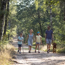
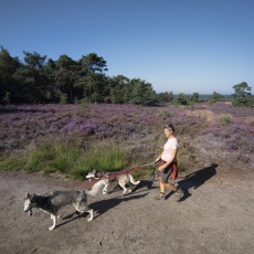
The first settlements arrived after the last Ice Age. Would you like to find out more about the origins of the Sallandse Heuvelrug? Read the brochure 'Geologie en Geomorfologie van de Sallandse Heuvelrug’ (‘Geology and Geomorphology of the Sallandse Heuvelrug). It comes with walking and cycling routes to interesting spots. Price: €6.75, available from Sallandse Heuvelrug Visitor’s Centre, Nature Diorama and Tourist Offices in the area.